


02188631942
Engineering, Procurement and Construction Project of Irrigation and Drainage Networks, Land Reclamation and Levelling and Sub-Surface Drainage in Ramshir County
Irrigation and Drainage, Key Projects
نام سرمایه گذار:
تاریخ ارسال:
موقعیت:
مقدار:
طراح:
درباره پرژوه
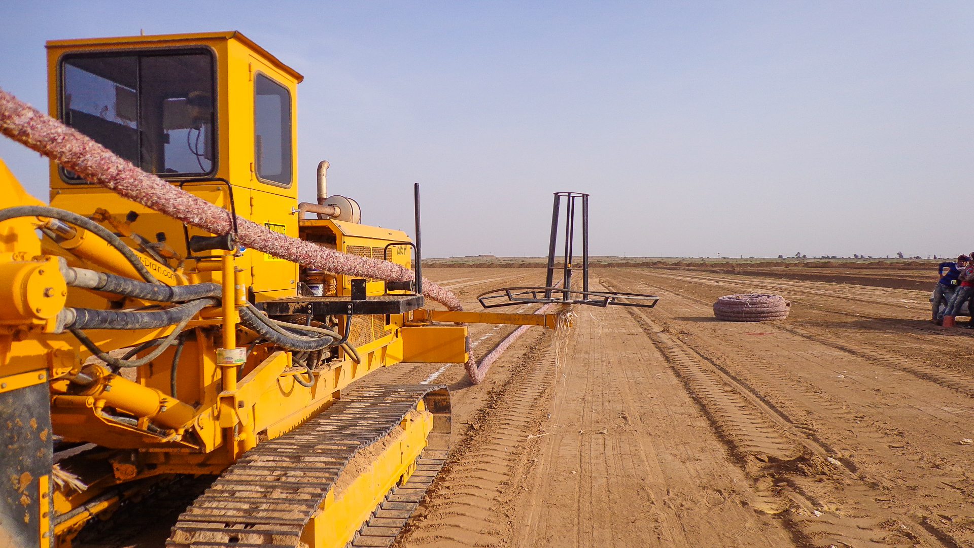
EPC project of irrigation and drainage networks, land reclamation and leveling and sub-surface drainage pipelines in Ramshir consisted of 5,600 hectares, including land leveling, sub-surface drainage, and canal construction, establishing gravity, low pressurized semi-mechanized and pressurized irrigation systems, and constructing tertiary and quad irrigation canals in the farms.
In this project to overcome hurdles including small and scattered pieces of land, Land Arrangement (ALA) Software package was designed and developed, the program was written in two ways for land segregation and farm rearrangement, and its accuracy was estimated at 1 square meter per hectare.
In addition, a program was coded in MATLAB to convert small canals to canals, in which besides converting trapezoidal cross sections to ellipsoid, it determines the best canal type based on flow rate, flow velocity and other design constraints.
Actual services:
In the project, Asarab formed a joint venture with Kermanshah Institute to provide consultancy services to the client. The services are listed below:
- Preparation of cadastral maps using a program developed in Visual Basic environment to calculate areas of lands for segregation considering buffers from canals and main drainages with an accuracy of one square meter per hectare (this software gained a technical approval certificate from the Supreme Informatics Council of Planning and Budget Organization)
- Preparation of soil salinity and alkalinity maps and hydraulic conductivity measurement
- Crop type mapping using time-series of Landsat-8 images and machine learning algorithms in MATLAB software
- Designing and measurement for land leveling using a program written in MATLAB and Excel environment in form of VB
- Designing tertiary and quad canals using a program written in MATLAB and Excel environment in form of VB to calculate size and diameter of irrigation and drainage canals
- The output of the abovementioned program was converted into AutoCAD and ArcGIS in form of maps and drawings
- Plumbing of drainage pipes and sub-surface collectors
- Supervision on road construction and maintenance
- Exploring the social and economic situation of the study area and achieving an understanding of the water and land utilization system
- Defining land and water utilization system in the area
- Investigating educational needs for utilizers to achieve an optimized utilization system
- Capacity building and educating utilizers to land consolidation and segregation of agricultural lands
- Capacity building and educating utilizers for following cropping pattern
